OS maps: No.1 in the charts since 1747
Now its maps are available on the web, Jonathan Brown plots a path through the history of the Ordnance Survey

For free real time breaking news alerts sent straight to your inbox sign up to our breaking news emails
Sign up to our free breaking news emails
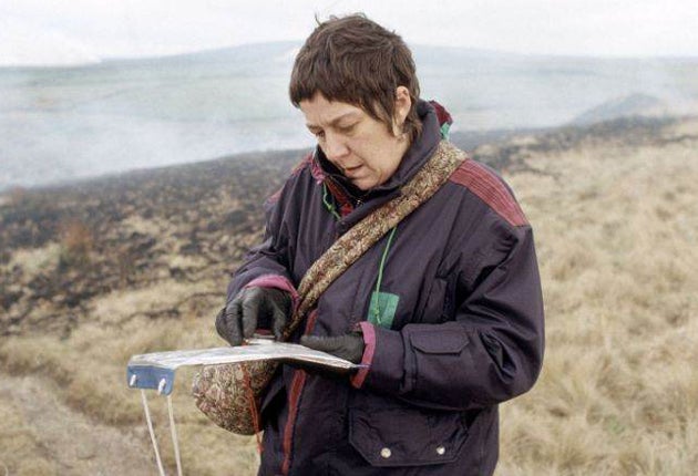
British wildernesses may be few and far between nowadays, but the urge to experience nature in the raw remains a primal impulse among the nation's hikers, bikers and fitness enthusiasts. And for anyone looking to venture into the great outdoors this weekend, an Ordnance Survey (OS) map remains the prerequisite piece of kit to be packed alongside an apple, a cagoul and a box of corned beef and pickle sandwiches to ensure a safe return from a day yomping across hill and dale.
Yesterday campaigners calling for greater availability of official data were joined by lovers of the British countryside in hailing a partial victory against the venerable state-mapping company, after it agreed to offer free and unrestricted access to most of its maps online.
The landmark decision by the OS followed a long public consultation designed to open up information sources gathered at the taxpayer's expense and to make them available to a new generation of users without charge. Among those welcoming the initiative was the creator of the World Wide Web, Sir Tim Berners-Lee, who has been advising Gordon Brown on ways to liberate the Government's vast data banks to a new wave of entrepreneurs who, it is hoped, may be able to use them to create cutting-edge industries.
Ministers were forced to waive the long-guarded copyright in response to the huge amount of mapping information already available on the internet free of charge. Services such as Google Earth, Street View and Multimap have revolutionised the way that the public perceives and pays for cartographical information.
OS OpenData, which went online yesterday, will exist alongside an earlier data-sharing scheme called OS OpenSpace, which is also free to groups looking to create and reproduce their own maps. It has brought an end to the absurdity of schoolchildren having to write for permission to photocopy a map from their public library.
The popularity of the service was immediately evident as the OS website became locked up with users rushing to download maps of their area for the first time.
But not everyone was entirely happy. The Ramblers, a charity which represents Britain's army of hikers and walkers, criticised the omission of the most popular scale paper maps after it was confirmed that the free datasets would not include digital versions of 1:25,000 Explorer and 1:50,000 Landranger series.
The charity's chief executive, Tom Franklin, accused the Government of "losing its nerve". He said: "We know one of the reasons people don't walk more is that they don't know good places to walk, and access to mapping is essential in overcoming that barrier. And more people walking more often is something the Government agrees is a good thing, helping tackle obesity and even climate change."
The OS said the decision to leave out the best-selling paper maps, which retail for anything up to £15 each, was "in the national interest" and could "undermine the continued provision of a nationwide paper map series".
Today, the geographically curious among us love nothing more than poring over the exquisitely drawn contour lines and triangulation marks of an OS map. Yet while modern-day OS maps may be viewed as documents of peace, beneficial to health and the environment, their origins are soaked in the blood of Jacobite suppression.
According to Dr Richard Oliver's A Short History of the Ordnance Survey of Great Britain, the first modern maps took shape between 1747 and 1755. Their instigator was an ambitious military officer named Colonel David Watson, who served with the Army and also the Engineers of the Board of Ordnance. The painstaking work was carried out by the Lanarkshire-born surveyor William Roy, who went on to become the father of modern cartography, and the pioneering water colourist Paul Sandby, who helped turn the first maps into beautifully realised artworks. It was a primitive process by modern satellite-driven standards. The contour line was yet to be invented, and all distances were measured by 66ft lengths of chain.
The Jacobite uprising of 1745 had caused consternation to King George II, who urgently commissioned the Highlands survey as a means of pacifying the insurgent clansmen north of the border. Overseeing the project was the formidable figure of the Duke of Cumberland, later to achieve notoriety as the "Butcher" of Culloden, architect of the murderously one-sided battle where 2,000 Jacobites were killed or wounded at the cost of just 50 government lives.
Perhaps inevitably, however, it was to be events across the Channel that were to drive the next stage in development. A dispute between the Royal Societies of London and Paris saw the great and the good of the learned bodies try to resolve a long-running disagreement over the relative positions of their astronomical observatories. The system of triangulation settled the debate – a process whereby distances across water and other obstacles were measured for the first time using the angles of a fixed point.
Yet throughout the 19th and 20th centuries, conflict continued to fuel the need for ever more accurate and detailed maps. In England, the first charting of the rolling farmland of Kent and the marshes of Essex appeared amid mounting concern over the prospect of invasion by Napoleon's forces.
By the time that the Battle of Waterloo was won, everywhere south of Birmingham was mapped. The work was physically demanding and progress was slow. It was not until 1823 that the survey had inched its way northwards armed with the advanced Ramsden theodolite for measuring vertical angles. Thomas Colby, the longest serving Director General of the Ordnance Survey, walked 586 miles in 22 days during one reconnaissance journey.
In 1841, at the time of the railway boom, officials were granted the right by Parliament to enter property in order to measure it. But disputes over which scale to adopt and the distractions of mapping Ireland failed to stem the advance of the theodolite-wielding geodesists, who continued to press ahead with their task and who have been carefully measuring, mapping and remapping the whole of the UK on a near-constant basis ever since.
Dr Christopher Board, chairman of the Charles Close Society for the Study of Ordnance Survey Maps, said the process of mapping the UK would never be complete and needed to remain largely state-funded. "If you left it to private industry you would find the most popular tourist areas would be mapped regularly and kept up to date, but there would be huge areas of agricultural land, moor or croft that would be left untouched," he said.
Subscribe to Independent Premium to bookmark this article
Want to bookmark your favourite articles and stories to read or reference later? Start your Independent Premium subscription today.
Join our commenting forum
Join thought-provoking conversations, follow other Independent readers and see their replies