Thanksgiving weather forecast: How snow, storms, and heavy rain could disrupt holiday travel
Region-by-region forecast is essential holiday travel preparation

The latest headlines from our reporters across the US sent straight to your inbox each weekday
Your briefing on the latest headlines from across the US
Thanksgiving is one of the biggest travel rushes of the year. According to AAA, an estimated 55 million travellers will be trekking more than 50 miles or more this Thanksgiving holiday, roughly 1.6 million more than last year. But in some places, the weather could throw a wrench in the plan. Will Mother Nature cooperate with your plans?
Here's the region-by-region Thanksgiving travel forecast:
- National overview: The big weather maker to watch will develop over the nation's midsection Tuesday. The strengthening area of low pressure will take a jaunt northeastward, possibly dropping snow on its north side through sections of the northern Plains and Great Lakes while dragging a front to the south. Gusty to strong winds will accompany the storm's passage as it moves from the Great Lakes and skirts northern New England. In its wake, high pressure will build in from the north.
Meanwhile, the West will be predominantly dry, but an upper-level low will bring a moist, onshore flow into California. That could bring some desperately-needed rain to portions of southern and central California, with a chance of snow in the higher elevations. The disturbance will eventually kindle the nation's next large-scale storm system over the Plains in about a week's time.
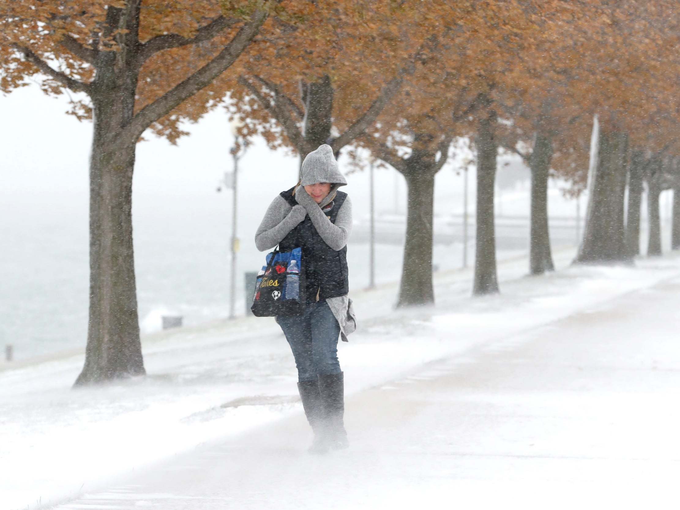
- Great Lakes: The Great Lakes will bear the brunt of the approaching storm system. If you're travelling to locations such as Chicago, Milwaukee, Madison and Green Bay, Wisconsin, and even Detroit, closely monitor forecasts as some disruptions are possible.
Precipitation may arrive in Chicago around the middle of Tuesday, increasing in intensity and spreading into much of northern Illinois, Wisconsin, northern Indiana and Michigan by the evening. The heaviest precipitation - much of which could fall as snow, especially on the cooler backside in Wisconsin - will fall north of the storm's centre Tuesday night into early Wednesday.
Chicago is more likely to see rain than snow, but a bit of snow could develop on the storm's backside very late Tuesday night into Wednesday.
Precipitation should exit to the east by late Wednesday. Strong winds will enter the region Tuesday afternoon, building overnight and peaking Wednesday. Gusts of 40 to 50 mph are possible. That could lead to flight delays. Winds should subside on Thursday.
Temperatures on Tuesday look seasonable with highs in the 30s and 40s. Temperatures Wednesday will depend on exactly where the system tracks.
Highs on Thanksgiving Day will range from the 30s north to 40s south.
- Northern Plains:A bit of rain and/or wet snow is possible Tuesday from the High Plains in Colorado and Wyoming through Iowa as the disturbance fuelling the building storm system ripples through. The Dakotas look to miss out.
Otherwise, Tuesday looks especially chilly. Wednesday may be a transition day before somewhat milder weather returns for Thursday and Friday.
Weather photographer of the year, 2019
Show all 24- Southern Plains: On Tuesday and Wednesday, a stationary front could lead to an enormous temperature contrast over the Lone Star State, with 30s and 40s in the Texas Panhandle and upper 70s to near 80 along the Gulf Coast. Oklahoma should hover in the 40s.
Rain is possible in Texas Thursday as moisture begins to build. Some of it may be moderate to heavy, but exactly when/wear is a low confidence forecast.
- Northeast: If you're escaping early on Tuesday, no weather worries. Temperatures will range from close to 50 degrees south, to the upper 30s and lower 40s north/inland.
Southerly winds will increase during the day on Wednesday, with gusts in excess of 30 mph by lunchtime possible. That could warm up Massachusetts, Connecticut, and Rhode Island to unseasonable levels. Meanwhile, light showers may enter the region by late morning, with a better chance in northern New England. The system does not look like a soaker at this point.
Clouds will linger early Thursday, especially in northern regions. Skies should brighten for southern New England as high pressure builds in. However, Thursday may feature strong winds thanks to the sharp pressure gradient caused by the two adjacent weather systems, with gusts topping 40 mph possible. Those northwesterly winds should usher in chillier air, with a downright cold day possible Friday. Strong winds could inhibit air travel.
- Mid-Atlantic: Expect pretty mild weather with temperatures well into the 50s on Tuesday, and Wednesday could warm into the 60s. Nothing is set in stone, but that's a distinct possibility if the approaching storm system - which will pass well to the north - gets those southerly winds cranking out ahead of it.
Wednesday will be breezy, with stronger gusts possible in the Appalachian peaks.
It then looks like the northern New England storm system will drag a cold front through late Wednesday into Thanksgiving Day, when highs are likely to struggle to hit 50.
- Southeast: Tuesday will be seasonable, but Wednesday could feel like late September or early October before a possible cold front moves through. Even if it's quick to pass through, like the American model indicates, Florida will still be summer-like on Thursday. Of course, it's way too early to tell the exact timing of the front.
Models are indicating a bit of shower activity may accompany the front, particularly along and north of the Interstate 20 corridor.
- Tennessee Valley and Deep South: Tuesday and Wednesday look uneventful. A stationary front may set up across the area draped southwest to northeast during much of the midweek. North of the front, 50s are possible. In southern areas, upper 60s or even lower 70s may be in the offing.
The Global Forecast System keeps this stationary front a bit sharper and more dramatic, which would help focus a few showers along it Wednesday into Thursday. The European model keeps the temperature gradient gentler, but is a bit more widespread with lighter shower activity.
All told, Wednesday and Thursday may be a bit sporadically unsettled, but it's by no means a washout.
- Intermountain West: Light showers are possible, especially in southern areas, Tuesday beneath an approaching upper-level low. A better chance for widely scattered precipitation comes across the Four Corners region on Wednesday.
By Thursday, heavier rain may target the Desert Southwest as the first significant winter storm may try to take shape in the West.
- West: Tranquil in the Pacific Northwest, but unsettled for much of central and southern California. Pockets of rain are possible, with snow in the Sierra Nevada.
Subscribe to Independent Premium to bookmark this article
Want to bookmark your favourite articles and stories to read or reference later? Start your Independent Premium subscription today.
Join our commenting forum
Join thought-provoking conversations, follow other Independent readers and see their replies